Territories

Territory Management & Analysis

Create territories, auto-assign them to records, calculate aggregate metrics, and view demographics. With a geo-library of ZIP codes, counties, and census areas and real-time assignment to any CRM object.

Draw and auto-assign territories are included in the Pro and Enterprise plans. See pricing

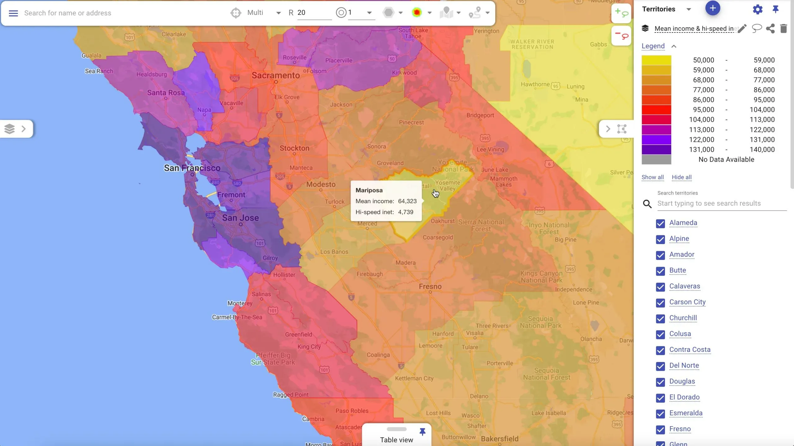
Mapsly map with territories colored by a demographic metric and a color scale legend

What a Territory Does in Mapsly

A territory is a map shape made of one or more polygons. You use territories for two things.

  • Assign records automatically

    Records from any object, including custom objects, are assigned to territories based on their location. How assignment works

  • Show and color data

    Display territory data fields and color territories by their numeric fields (metrics). About data fields

Five ways

How to Create Territories

  1. Draw on the map

    Draw territories manually, one by one, right on the map.

  2. Combine areas

    Build a territory from pre-loaded areas in the geo-library, like ZIP codes or counties.

  3. Mass-generate

    Create many territories at once from the geo-library, for example one per selected county.

  4. Import a file

    Upload shapes from KML, KMZ, GeoJSON, or ESRI Shapefile files.

  5. Create in code

    Use Mapsly automation to create territories and change their color, fields, and geometry.

Auto-assignment

Records Land in the Right Territory, Automatically

When a record is imported from your CRM or its location changes, Mapsly immediately assigns it to every territory it falls inside. Assignment can trigger Mapsly workflows, for example to assign the record to a sales rep.

Assigned territories appear in the Territory field of every Mapsly object, so you can filter maps and tables by them. You can also save assigned territories back to your CRM, per object, to report or trigger workflows there.

It takes 15–20 seconds from import to assigning a record and saving its territories back to the CRM.

Configure automatic assignment
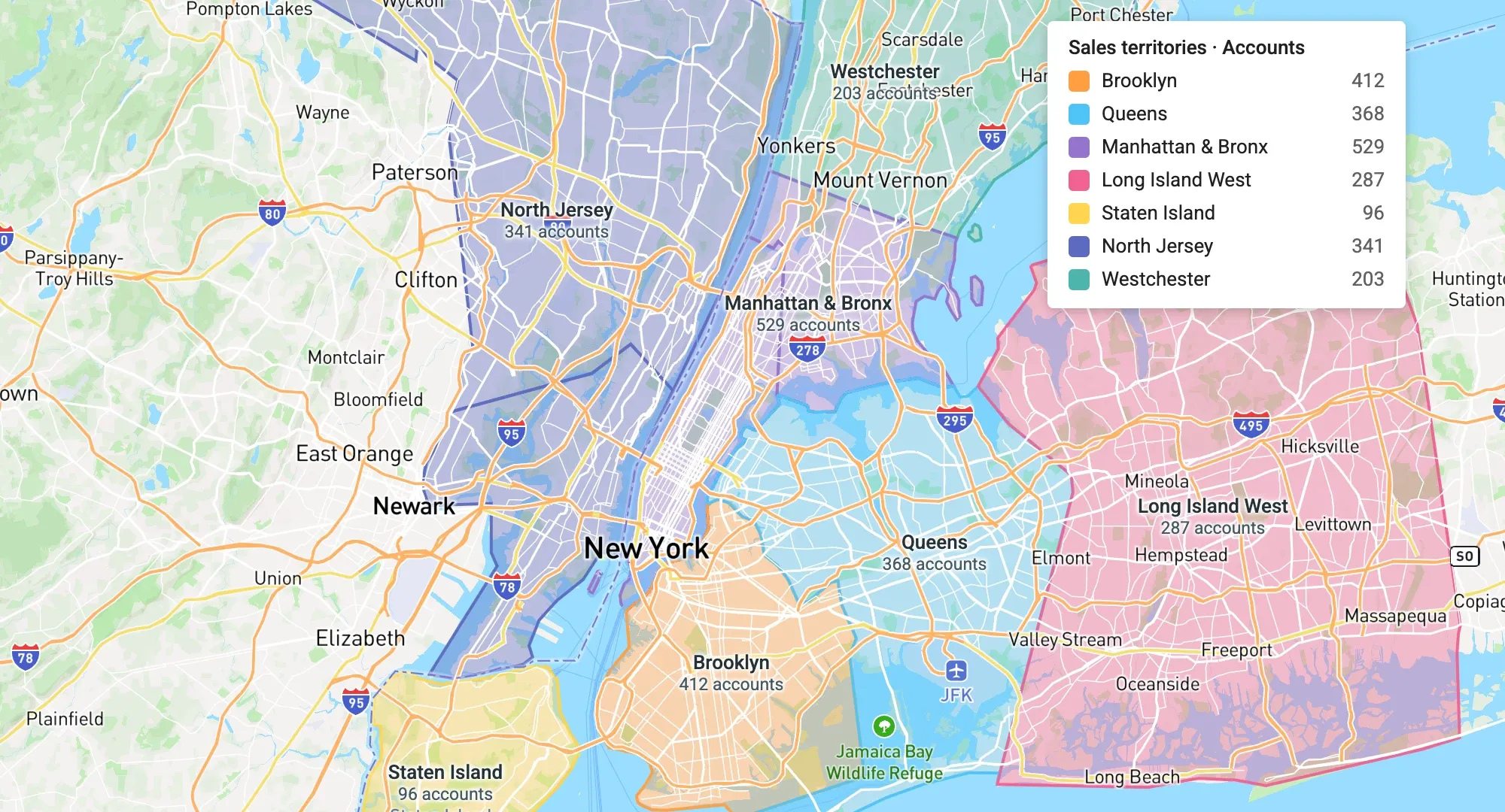
Territories drawn over New York with records assigned by location

Data fields & metrics

Three Kinds of Territory Data

Show data fields in territory names and map popups. Numeric fields (metrics) can color territories on a configurable scale.

  • Aggregate metric

    Calculated automatically from the records inside the territory: a record count, or the SUM, MAX, MIN, or AVG of any field.

  • Demographic metric

    Pre-loaded US Census Bureau data for territories built from census-based areas such as ZIP code tabulation areas, counties, census tracts, and block groups.

  • Custom data field

    A field you fill in per territory: by hand, through Mapsly automation, or from an imported file.

Learn about territory metrics

Territory groups

Configure Properties, Fields, and Sharing per Group

Every territory belongs to a group, the same way a map layer belongs to a layer group. Each group (except Default) sets:

  • Default properties

    Color, naming template, internal boundaries for composite territories, and whether component area names show. Override any of them per territory.

  • Data fields

    Which fields every territory in the group has, their types, and how aggregate metrics are calculated.

  • Sharing

    Share the group with specific users, user profiles, or make it public to everyone in your Mapsly organization.

Share a map with preconfigured territories by link, embed it in a website, portal, or dashboard, or send it by email. Sharing and embedding maps

FELFEL technician servicing a smart fridge

Customer story

How FELFEL Cut Planning Time from a Week to a Day and Doubled Field Efficiency

By eliminating manual route planning, tool-hopping, and error-prone communication, FELFEL streamlined nationwide fridge maintenance, emergency responses, and field coordination.

Read the story

Unlock 3X Productivity for Your Team:
Get Your Complete Field Team Playbook

Strategies from high-performing field teams to save hours, capture perfect data, and deliver more visits every day.

Cover of the guide Triple Your Field Team's Productivity

Ready to Get Started?

Start a free 14-day trial of the full platform, or let a solution engineer build a proof of concept for your team.

No credit card required · Chat with sales